
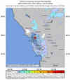
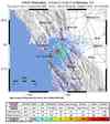
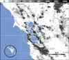
Magnitude 3.6 - SAN FRANCISCO BAY AREA, CALIFORNIA
2011 October 27 12:36:44 UTC
Earthquake Details
- This event has been reviewed by a seismologist.
| Magnitude | 3.6 |
|---|---|
| Date-Time |
|
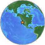
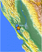
| Location | 37.873°N, 122.251°W |
| Depth | 9.7 km (6.0 miles) |
| Region | SAN FRANCISCO BAY AREA, CALIFORNIA |
| Distances |
|
| Location Uncertainty | horizontal +/- 0.2 km (0.1 miles); depth +/- 0.4 km (0.2 miles) |
| Parameters | Nph= 83, Dmin=1 km, Rmss=0.17 sec, Gp= 29°, M-type=regional moment magnitude (Mw), Version=6 |
| Source | |
| Event ID | nc71671256 |
- Did you feel it? Report shaking and damage at your location. You can also view a map displaying accumulated data from your report and others.
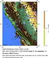

.gif) Historic Moment Tensor
Solutions
Historic Moment Tensor
Solutions