 |  |
| (Station Photograph - click to enlarge) | (Sensor Layout - click to see PDF File) |
| CESMD |
| Information for Strong-Motion Station |
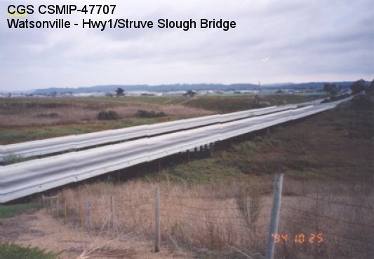
| Watsonville - Hwy1/Struve Slough Bridge |
| CGS - CSMIP Station 47707 |
| Earthquakes recorded by this station |
| |
| (Station Photograph - click to enlarge) | (Sensor Layout - click to see PDF File) |
| Latitude | 36.9067 N |
| Longitude | 121.7818 W |
| Elevation (m) | 2 |
| Site Geology | |
| Vs30 (m/sec) | |
| Site Class |
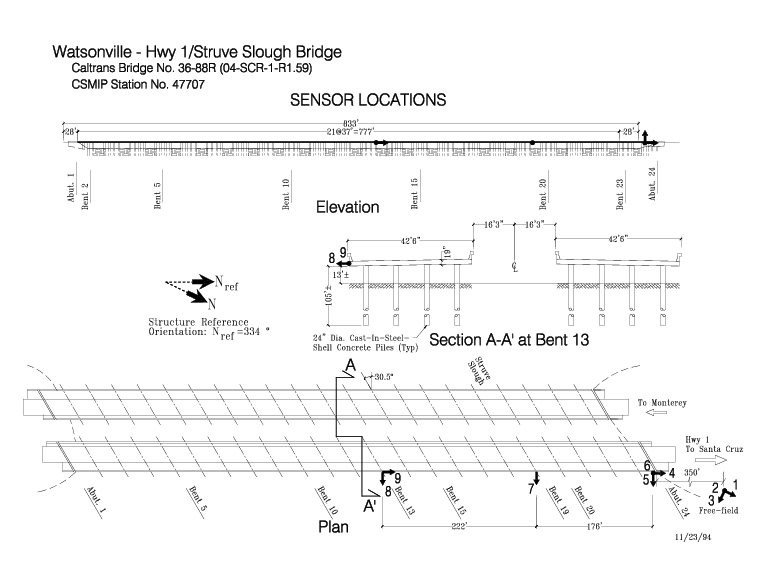
| No. of Spans | 22 (Left Bridge), 23 (Right Bridge). |
| Plan Shape | Straight with skew. |
| Total Length | 796' (242.6m) Left Bridge. 833' (253.9m) Right Bridge. Bridge spans are 37' (11.3m) and 28' (8.5m) between bent and abutment. |
| Width of Deck | 42.5' (13.0m) each bridge. |
| Construction Date | 1990 |
| Instrumentation | 1994. 6 accelerometers on the bridge. 3 accelerometers at a free-field site. |
| Superstructure Type | Continuous concrete slabs without intermediate hinges. Expansion joints at each abutment. Open end seat abutments. |
| Substructure Type | Cast-in-steel-shell concrete piles. Each bent consists of 4 pile extensions. |
| Foundation Type | Cast-in-steel-shell concrete piles. |
| Remarks | This bridge was instrumented under the interagency agreement between Caltrans and DOC. |