 |  |
| (Station Photograph - click to enlarge) | (Sensor Layout - click to see PDF File) |
| CESMD |
| Information for Strong-Motion Station |
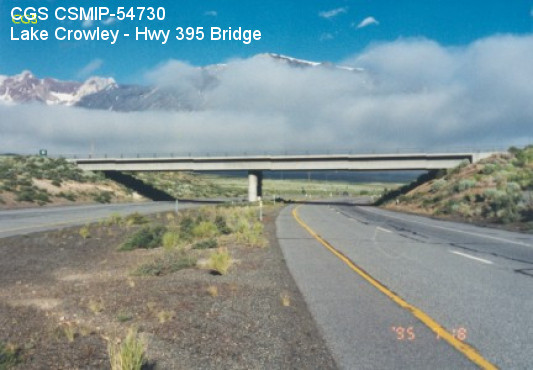
| Lake Crowley - Hwy 395 Bridge |
| CGS - CSMIP Station 54730 |
| Earthquakes recorded by this station |
| |
| (Station Photograph - click to enlarge) | (Sensor Layout - click to see PDF File) |
| Latitude | 37.5733 N |
| Longitude | 118.7390 W |
| Elevation (m) | 2089 |
| Site Geology | Alluvium |
| Vs30 (m/sec) | 305 (inferred) |
| Site Class | D |
| Remarks/Notes | Site information sources |
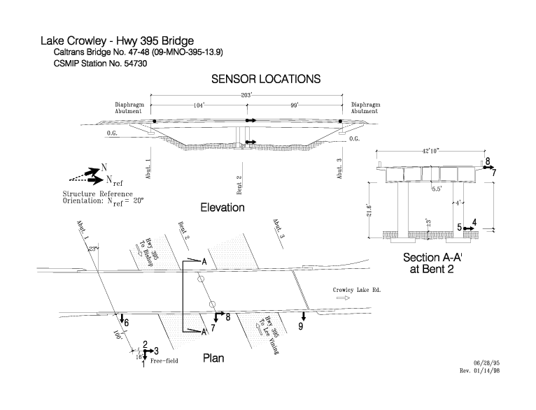
| No. of Spans | 2 |
| Plan Shape | Straight with skew. |
| Total Length | 203' (61.9m). Bridge spans are 99' (30.2m) and 104' (31.7m) long. |
| Width of Deck | 43' (13.1m) |
| Construction Date | 1969 |
| Instrumentation | 1995. 6 accelerometers on the bridge. 3 accelerometers at a free-field site. |
| Superstructure Type | Continuous concrete box girder. Diaphragm abutments. |
| Substructure Type | Circular concrete columns. 2 columns per bent. |
| Foundation Type | Spread footings. |
| Remarks | This bridge was instrumented under the interagency agreement between Caltrans and DOC. |