 | 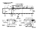 |
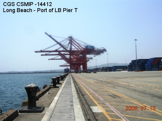
| (Station Photograph - click to enlarge) | (Sensor Layout - click to see PDF File) |
| CESMD |
| Information for Strong-Motion Station |
| Long Beach - Port of LB Pier T |
| CGS - CSMIP Station 14412 |
| Earthquakes recorded by this station |
| |
| (Station Photograph - click to enlarge) | (Sensor Layout - click to see PDF File) |
| Latitude | 33.7554 N |
| Longitude | 118.2301 W |
| Elevation (m) | -- |
| Site Geology | |
| Vs30 (m/sec) | |
| Site Class |
| No. of Spans | 2 |
| Plan Shape | Rectangular |
| Total Length | 113.75 ft |
| Width of Deck | 152.75 ft and 570 ft |
| Construction Date | 2005 |
| Instrumentation | 2009, 15 accelerometers on the Pier and 3 at a free-field site. |
| Superstructure Type | concrete slab supported by 24" prestressed concrete piles. |
| Substructure Type | Decks with five straight piles in the transverse direction . On the land side, the drag beam with the deck and the trust beam supported by two battered piles form the seismic fuse. |
| Foundation Type | Prestressed concrete piles (about 70 feet long). |
| Remarks | -- |