 |  |
| (Station Photograph - click to enlarge) | (Sensor Layout - click to see PDF File) |
| CESMD |
| Information for Strong-Motion Station |
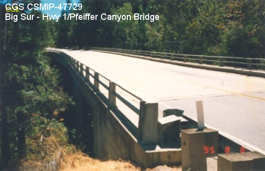
| Big Sur - Hwy 1/Pfeiffer Canyon Bridge [Demolished] |
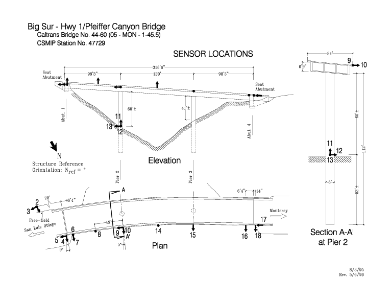
| CGS - CSMIP Station 47729 |
| Earthquakes recorded by this station |
| |
| (Station Photograph - click to enlarge) | (Sensor Layout - click to see PDF File) |
| Latitude | 36.2391 N |
| Longitude | 121.7747 W |
| Elevation (m) | 176 |
| Site Geology | Alluvium |
| Vs30 (m/sec) | 664 (inferred) |
| Site Class | C |
| Remarks/Notes | Site information sources |
| No. of Spans | 3 |
| Plan Shape | Curved. |
| Total Length | 316' (96.3m). Bridge spans are 98.25' (29.9m), 120' (36.6m), and 98.25' (29.9m). |
| Width of Deck | 34' (10.4m) |
| Construction Date | 1968 |
| Instrumentation | 1996. 15 accelerometers on the bridge. 3 accelerometers at a free-field site. |
| Superstructure Type | 3-cell concrete box girder. Seat abutments with rocker bearings. |
| Substructure Type | Circular (6' diameter) reinforced concrete column at each pier. |
| Foundation Type | Concrete pile shafts support the piers. Spread footings support the abutments. |
| Remarks | This bridge was instrumented under an interagency agreement between Caltrans and DOC. |