 | 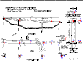 |
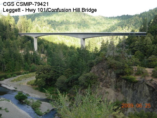
| (Station Photograph - click to enlarge) | (Sensor Layout - click to see PDF File) |
| CESMD |
| Information for Strong-Motion Station |
| Leggett - Hwy 101/Confusion Hill Bridge |
| CGS - CSMIP Station 79421 |
| Earthquakes recorded by this station |
| |
| (Station Photograph - click to enlarge) | (Sensor Layout - click to see PDF File) |
| Latitude | 39.9213 N |
| Longitude | 123.7634 W |
| Elevation (m) | 245 |
| Site Geology | |
| Vs30 (m/sec) | |
| Site Class |
| No. of Spans | 3 |
| Plan Shape | Straight |
| Total Length | 413 meters |
| Width of Deck | 13 m |
| Construction Date | 2009 |
| Instrumentation | 2009. 21 accelerometers on the bridge. 3 accelerometers at a free-field site near North Abutment. |
| Superstructure Type | Cast-in-place segmental concrete box girder (one-cell). |
| Substructure Type | Hollow box concrete column; one column at each pier. The column height is 51.5 m and 51.25 m, at Piers 2 and 3, respecively. |
| Foundation Type | Piers 2 and 3 are supported by pile caps on 11 1.5m-diameter CIDH concrete piles. Abutments are seat typed with PTFE bearings and supported on CIDH concrete piles. |
| Remarks | The bridge was instrumented during construction under the interagency agreement between Caltrans and DOC/CGS. |