 | 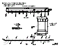 |
| (Station Photograph - click to enlarge) | (Sensor Layout - click to see PDF File) |
| CESMD |
| Information for Strong-Motion Station |
| Klamath - Hwy 101/Klamath River Bridge |
| CGS - CSMIP Station 99710 |
| Earthquakes recorded by this station |
| |
| (Station Photograph - click to enlarge) | (Sensor Layout - click to see PDF File) |
| Latitude | 41.5174 N |
| Longitude | 124.0307 W |
| Elevation (m) | -- |
| Site Geology | |
| Vs30 (m/sec) | |
| Site Class |
| No. of Spans | 12 |
| Plan Shape | Straight with skew. |
| Total Length | 2038' (621.2m). Bridge spans range from 143' (43.6m) to 175' (53.3m) long. |
| Width of Deck | 34' (10.4m) |
| Construction Date | 1965 |
| Instrumentation | 1995: 6 accelerometers on the bridge. 2019: 1 vertical accelerometer added. |
| Superstructure Type | 3-cell concrete box girder with 4 intermediate hinges. Concrete diaphragm abutments. |
| Substructure Type | Hollow concrete piers. 1 column per pier. |
| Foundation Type | Steel piles. |
| Remarks | This bridge was instrumented under the interagency agreement between Caltrans and DOC. |