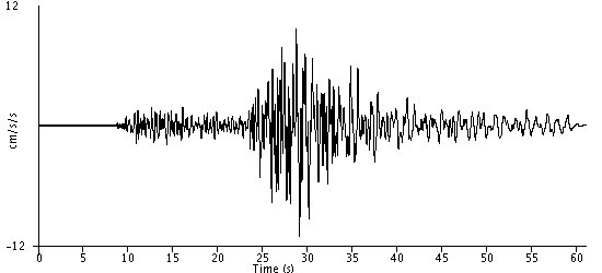
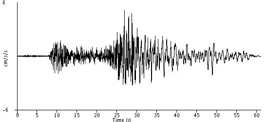
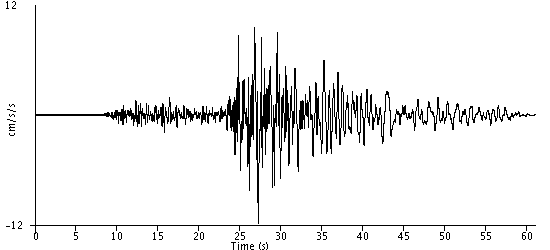
Acceleration
Station: Chino Hills - Hwy 71 & Eucalyptus
Station Owner: California Strong Motion Instrumentation Program
Station Latitude & Longitude: 33.9901, -117.7178
Earthquake: Borrego Springs 2010-07-07 16:53:33 UTC
Hypocentral Distance: 131.0 km
(Use the back button on your browser to return to the previous page)
|