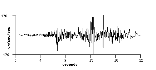
Acceleration
Station: Calipatria, CA - Fire Station
Station Owner: United States Geological Survey
Station Latitude & Longitude: 33.1266, -115.5159
Earthquake: Superstition Hills 1987-11-24 13:15:56 UTC
Hypocentral Distance: 32.9 km
(Use the back button on your browser to return to the previous page)
|